LONDON, Ont. — A tornado that touched down in Northwestern Ontario last week had an estimated maximum wind speed of 190 km/h.
There may also have been one or two others when a storm system passed through on June 4.
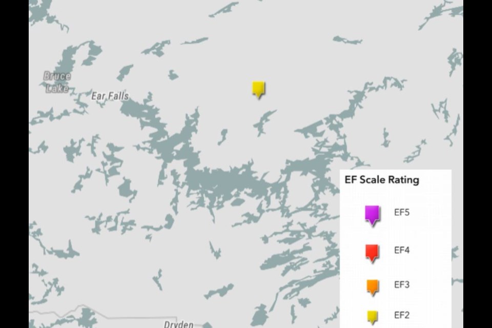
The Northern Tornadoes Project, based at Western University in London, is reporting preliminary results from its investigation of the weather event, which occurred east of Ear Falls.
So far, researchers have found evidence of damage from an EF2 tornado, which is a tornado with wind speeds between 178 and 217 km/h.
NTP is a group that collaborates with Environment Canada to find and document tornadoes across the country.
Its analysis of the recent storm system in the Northwest included the use of high-resolution satellite imagery that shows what happened after the tornado reached the ground near Landings Lake, north of Lac Seul.
The images reveal a long, narrow track of damage through the forest.
NTP said based on the extent of tree damage, the estimated maximum wind speed was 190 km/h, and the track of the storm on the ground is 5.67 km long, with a maximum width of 350 metres.
"At the moment, this is the only known damage from the numerous storms in NW Ontario that day," the team wrote. "It appears that at least one of the other storms was most intense as it moved over water."
Radar and satellite imagery analysis is ongoing.
In an interview Wednesday, Northern Tornadoes Project executive director David Sills told TBnewswatch "there were quite a few storms and tornado warnings issued that day. It's been kind of cloudy [lately] so we haven't been able to look at very good imagery over the last few days, but just yesterday some clear imagery came in and we're able to see one tornado track at Landings Lake."
He said based on additional significant storm cells that were also captured on radar that day, especially southeast of Dryden, "we're expecting that we might find one more, maybe two more tornadoes," however if they occurred over water, "it may be that there were some pretty epic waterspouts over the area."
Sills has reached out to tourist resorts in the area to inquire about any damage but hasn't heard of any yet.
"We've got a couple more days, maybe a week, to wait to get the clear images that we need to do the analysis."
Environment Canada is predicting a warmer-than-normal summer for much of Northwestern Ontario, but Sills said that doesn't necessarily mean violent storms are more likely to occur.
"It depends on where the storm track sets up. If you're on this storm track, you may get a lot of cold fronts coming through, and that might not be the warmest situation up there, whereas if you get a lot of big high pressure systems, a lot of hot weather, sometimes that can shut down thunderstorm activity."
In June 2020, the Northern Tornadoes Project team investigated Ontario's first tornado of the year, which occurred near Nestor Falls.
